Beyond the Fence Line: Why Wildlife Conservation at EC Wildlife Refuge Depends on the Surrounding Landscape
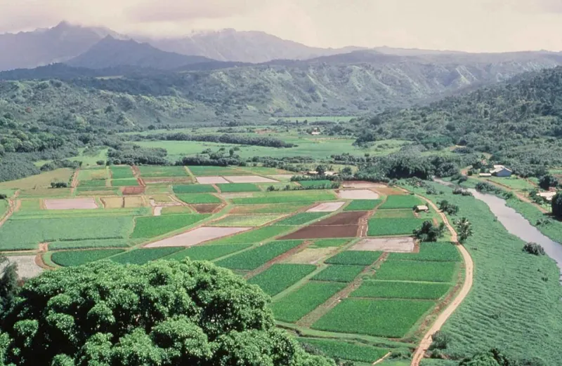
Photo: Eilerts Bruce, U.S. Fish and Wildlife Service, Public domain, via Wikimedia Commons
Draw a line around any protected area on a map, and you have captured something real—a place where land is managed with wildlife in mind, where development pressure is held at bay, where ecological processes are given room to operate. But draw that same line in the mind of a white-tailed deer, a wood turtle, or a migrating songbird, and it means almost nothing. Animals move. They always have. And the degree to which they can continue to do so, across landscapes that extend far beyond any single refuge, determines whether conservation efforts inside those boundaries will ultimately succeed.
At EC Wildlife Refuge, this reality shapes both daily management decisions and long-term strategic planning. The refuge is not an island—it is a node within a larger ecological network, and the health of that network matters as much as the quality of habitat within the refuge itself.
The Problem with Patches
Conservation biology has grappled for decades with a fundamental tension: protected areas are finite, but the ecological processes they are meant to sustain are not. Island biogeography theory, developed in the 1960s and extensively refined since, demonstrated that isolated habitat patches lose species over time at predictable rates. The smaller and more isolated a patch, the faster its biodiversity erodes.
This is not merely a theoretical concern. Across the eastern United States, forests, wetlands, and grasslands have been subdivided by roads, agricultural fields, and suburban development into a fragmented mosaic. Species that once moved freely across this landscape now encounter barriers at every turn. The consequences are biological as well as behavioral: isolated populations lose genetic diversity, become more vulnerable to disease and environmental disturbance, and are less capable of recovering from local population crashes.
For EC Wildlife Refuge, the implications are direct. Even with exemplary habitat management within its boundaries, the refuge cannot indefinitely sustain populations of wide-ranging species if those animals cannot move in, out, and through the surrounding landscape.
What the Data Reveal
Wildlife movement research has advanced considerably in recent years, driven by miniaturized GPS tracking technology, camera trap networks, and genetic sampling techniques that can reconstruct movement history from DNA alone. Studies conducted in collaboration with regional university partners have begun to document how animals associated with EC Wildlife Refuge use the surrounding landscape—and where the critical bottlenecks lie.
Tracking data from white-tailed deer and wild turkeys confirm that individuals regularly move between the refuge and adjacent agricultural and forested lands, sometimes covering several miles in a single night. River otter movement surveys along the refuge's connected waterway systems have documented animals traveling substantial distances between wetland complexes, using riparian corridors as travel routes.
Perhaps most revealing has been the genetic work. Population genetics analyses of wood turtles—a species of conservation concern throughout its range—have shown that individuals within the refuge share genetic markers with turtles sampled from wetlands several miles away, confirming that dispersal is occurring across the intervening landscape. However, the same analyses have identified stretches of road and developed land where genetic exchange appears to be reduced, suggesting that connectivity is not uniform and that certain landscape features are functioning as partial barriers.
The Corridor Concept in Practice
The term "wildlife corridor" has entered common usage, but its practical application is more nuanced than the word suggests. Corridors are not simply narrow strips of habitat connecting two protected areas—they are any landscape feature that facilitates animal movement, and they operate differently for different species. A riparian buffer that serves as a travel route for river otters may provide little benefit to a grassland-dependent butterfly. A forest patch that allows deer to move between woodlots may not meet the requirements of a forest-interior breeding bird.
EC Wildlife Refuge has approached connectivity not through a single corridor project but through a portfolio of initiatives tailored to the movement ecology of priority species. Several strategies have proven particularly relevant.
Landowner Partnerships and Voluntary Conservation Agreements
The land immediately surrounding EC Wildlife Refuge includes a mix of private farmland, timber holdings, and residential properties. Refuge staff have invested significant effort in building relationships with neighboring landowners, offering technical assistance for habitat management practices that benefit wildlife while remaining compatible with agricultural and forestry operations. Conservation easements, negotiated on a voluntary basis, have permanently protected several key parcels that serve as stepping-stone habitats between the refuge and more distant natural areas.
These partnerships require sustained investment in communication and trust. Landowners who understand the ecological role their property plays—and who have access to resources that make wildlife-friendly management financially viable—are far more likely to become long-term conservation allies.
Road Crossing Infrastructure
Roads represent one of the most significant barriers to wildlife movement in the eastern US. Vehicle collisions kill millions of animals annually, and roads alter animal behavior even where direct mortality does not occur—many species will not cross open pavement, effectively severing populations on either side.
In coordination with regional transportation agencies, EC Wildlife Refuge has participated in assessments identifying road segments where wildlife crossing infrastructure—culverts, underpasses, and fencing designed to guide animals toward safe crossing points—could meaningfully improve connectivity. Several installations have been completed, and camera monitoring at these structures has documented use by a range of species including deer, foxes, and small mammals.
Regional Landscape Initiatives
Connectivity at the landscape scale requires coordination that no single organization can provide alone. EC Wildlife Refuge participates in regional conservation planning initiatives that bring together federal and state agencies, land trusts, tribal nations, and private stakeholders to identify priority areas for habitat protection and restoration across multi-county geographies. These collaborative frameworks allow the refuge to align its management priorities with broader landscape-scale goals, ensuring that investments in on-site habitat quality translate into population-level benefits.
Why This Matters to Visitors
For those who visit EC Wildlife Refuge to observe wildlife, the connectivity of the surrounding landscape has direct consequences for what they are likely to encounter. Species that require large home ranges—black bears, bobcats, and wide-ranging raptors—will be present only if the landscape beyond the refuge can support their movement. The migratory birds that draw visitors each spring and fall depend on a chain of suitable habitat stretching from wintering grounds in Latin America to breeding sites in the northern US and Canada; the refuge is one link in that chain, and its value is inseparable from the integrity of the others.
Understanding this broader context enriches the visitor experience. When you observe a wood duck lifting from the refuge's wetlands and disappearing over the tree line, you are witnessing not just a single bird in a single place, but a participant in a landscape-scale ecological system that extends far beyond what any map of the refuge can show.
Conservation Without Borders
The work of protecting wildlife has always extended beyond the boundaries of any designated reserve. What has changed is our capacity to document the ecological processes that cross those boundaries—and to act on that knowledge through coordinated, multi-stakeholder strategies. EC Wildlife Refuge is committed to both: to maintaining the highest possible habitat quality within its boundaries, and to building the partnerships and landscape connections that allow that quality to translate into lasting conservation outcomes.
The fence line, in the end, is an administrative convenience. The ecosystem does not recognize it, and neither, ultimately, can effective conservation.